
Krisnaldi
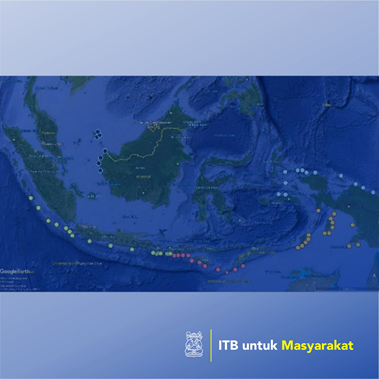
This research activities tried to identify wave energy resources in Indonesia waters, which include water on Indonesian waters in the border area, which positioned towards the open ocean such as Hindian Ocean, Pacific Ocean, and the South China Sea. Wave energy resources analysis conducted based on available wave data, provided by the MetOcean Solution website, which includes Indonesian waters which covers latitude of 100o East to 145o East and longitude of 7o North to 12o North. Average significant wave height data had been refered to indocate potential location for wave energy extraction. A Theoretical Resource can be then predicted based on Joint Probability Density Function (PDF) of wave height and wave period on selected location, which also indicates occurrence of certain seastate. This research activities can be concluded that: 1. Indonesian water south of Java island and West of Sumatra island, which oriented directly to the Indian Ocean provide highest values for Theoretical and Technical Resources for extraction of wave energy. 2. In the Eastern part of Indonesia, the water in the vicinity of Arafura Sea, South of Papua, have different wave characteristics and, based on available wave data, do not show adequate resources for wave energy extraction. 3. The waters north of Papua, which oriented directly to Pacific Ocean, and water around Natuna islands, which is close to South China Sea, show potential for wave energy extraction.
Penerapan Karya Tulis
Identify wave energy resources in Indonesia waters, which include water on Indonesian waters in the border area, which positioned towards the open ocean.