
Masyhur Irsyam
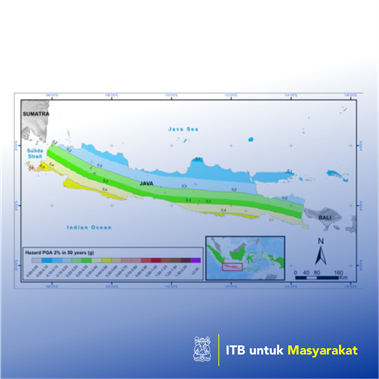
Improvements to GMPE will impact the software database used in seismic processing or analysis. Therefore in this study, PGA (Peak Ground Acceleration) analysis will be conducted on bedrock using modified PSHA USGS software with GMPE database updates, namely BC Hydro 2016 (Abrahamson et al., 2016; Nikolaou et al., 2017; Solakov et al., 2019), Campbel Bozorgnia 2014 (Campbell, 2016; Campbell & Bozorgnia, 2014), Boore Atkinson 2014 (Boore et al., 2014; Gregor et al., 2014) and Chiou Young 2014 (Baltay & Boatwright, 2015; Chiou & Youngs, 2014) in Java Island with earthquake catalogs sourced from National Research Center of Earthquake/ Pusgen (PusGen, 2017) to be compared with OpenQuake analysis. Java Island is one of the major islands in the country of Indonesia, Southeast Asia, lies in approximately 6°S-8°S and 103°E-114°E. The geographical study location is surrounded by active tectonic plates of the Philippines, Australia, Pacific and Euro-Asia. This condition results in many areas in Indonesia, including Java Island, being subducted and causing many earthquake hazards. Java Island is bordered by the Indian Ocean and Java Sea at the southside and northside, respectively . On the medial side, there are many active mountains found as the impact of the meeting of the plates. The presence of faults is also commonly found; so far, there are 66 active faults identified.
Penerapan Karya Tulis
Seismic analysis is perceived to be increasingly crucial along with the development of spatial and regional areas. This activity undertook changes with progress in the fields of science related to some interest study areas, such as geophysics, geology, seismology and civil engineering. At the time, this analysis began to develop started using a deterministic method, which only involved several sources of the earthquake, which was suspected of having a significant role in the area and the calculated point was the only point that had the chance of an earthquake occurring. After that, the probabilistic method is carried out which involves all existing earthquake sources assuming the analyzed area has the same chance of an earthquake occurring. In PSHA (Probabilistic Seismic Hazard Analysis), one of the parameters of concern is the GMPE (Ground Motion Prediction Equation), or often called attenuation where this equation connects the parameters of distance, magnitude, depth, ground/rock shear velocity and site class.