


Agustinus Adib Abadi
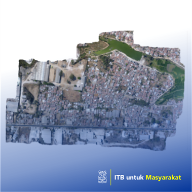
According to UN-Habitat, currently, about 25% of the world's urban population lives in slums. In Indonesia, according to data from the Ministry of Public Works and Public Housing, in 2018, there are 38,641 hectares of slum areas located in 269 cities/districts and 11,076 villages/villages. According to the Regulation of the Minister of Public Works and Public Housing of the Republic of Indonesia No14 / PRT / M / 2018, slums are settlements that are not habitable due to building irregularity, high density of building, and the quality of buildings and facilities and infrastructure that do not qualify. Fulfillment of the conditions in question is conformity to the fulfillment of technical standards and the ability of functions that include: building quality, tertiary roads; provision of drinking water; drainage; wastewater management; waste management; and fire protection. For more than 25 years, Indonesia has efforted to improve the quality of slums. Many local communities, cities, and international organizations have carried out various programs to deal with slums, but it has not shown significant results. The observations that there are problems handling slums in Indonesia are still not optimal because the handling process is inadequate. One of them is that slums' decision is still often missed because of the lack of data support in the decision-making process.
Penerapan Karya Tulis
The main problem raises as the understanding of the slums are very diverse. For certain conditions, the term describes a different level of settlement. The understanding starts from informal and illegal settlements to land rights status and the area that lacks planning. Spontaneous or irregular developments show the processes and dynamics of development, where severe deficiency, shacks, and sub-standards infrastructure are associated with poor physical and socio-economic conditions. Many terms used popularly about squall is widely associated with politics generally associated with the Agenda of habitat in development goals. However, slum alleviation efforts are less supported by comprehensive data and information so that the various policy decisions taken can be more effective. The condition requires integrating social data and remote sensing data to become comprehensive and measurable and reliable information as the primary purpose of this study. Often researchers intend to provide necessary information about squall location in urban networks and whether the area is large? However, it does not sufficiently integrate with existing social information.